Unrivaled Intelligence
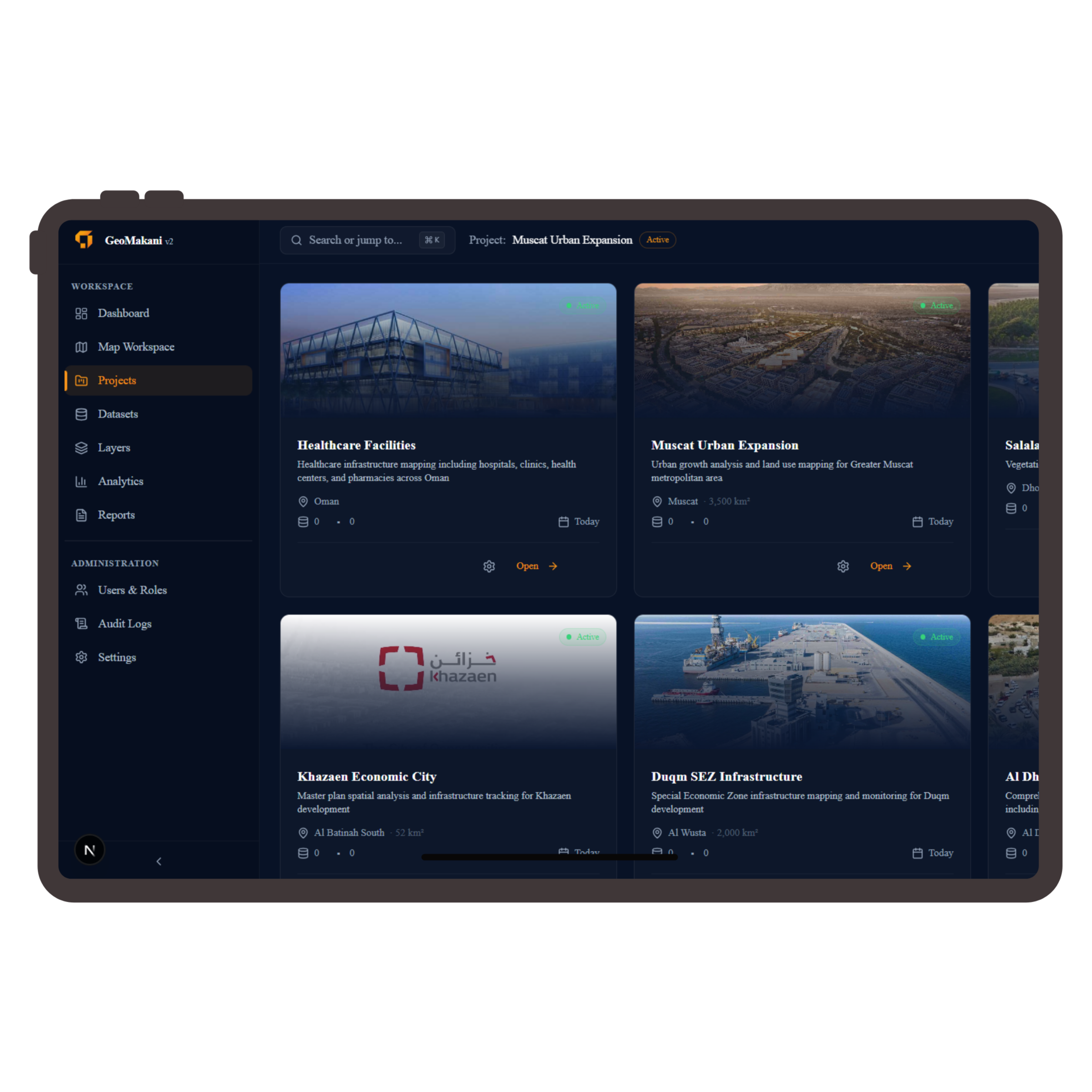
Manage Projects
Centralize your geospatial lifecycle from acquisition to archival. Collaborative workflows designed for multi-departmental coordination across Oman's infrastructure projects.
Analyze Spatial Data
Leverage advanced GIS processing engines to uncover patterns, trends, and anomalies in complex environmental and urban datasets.
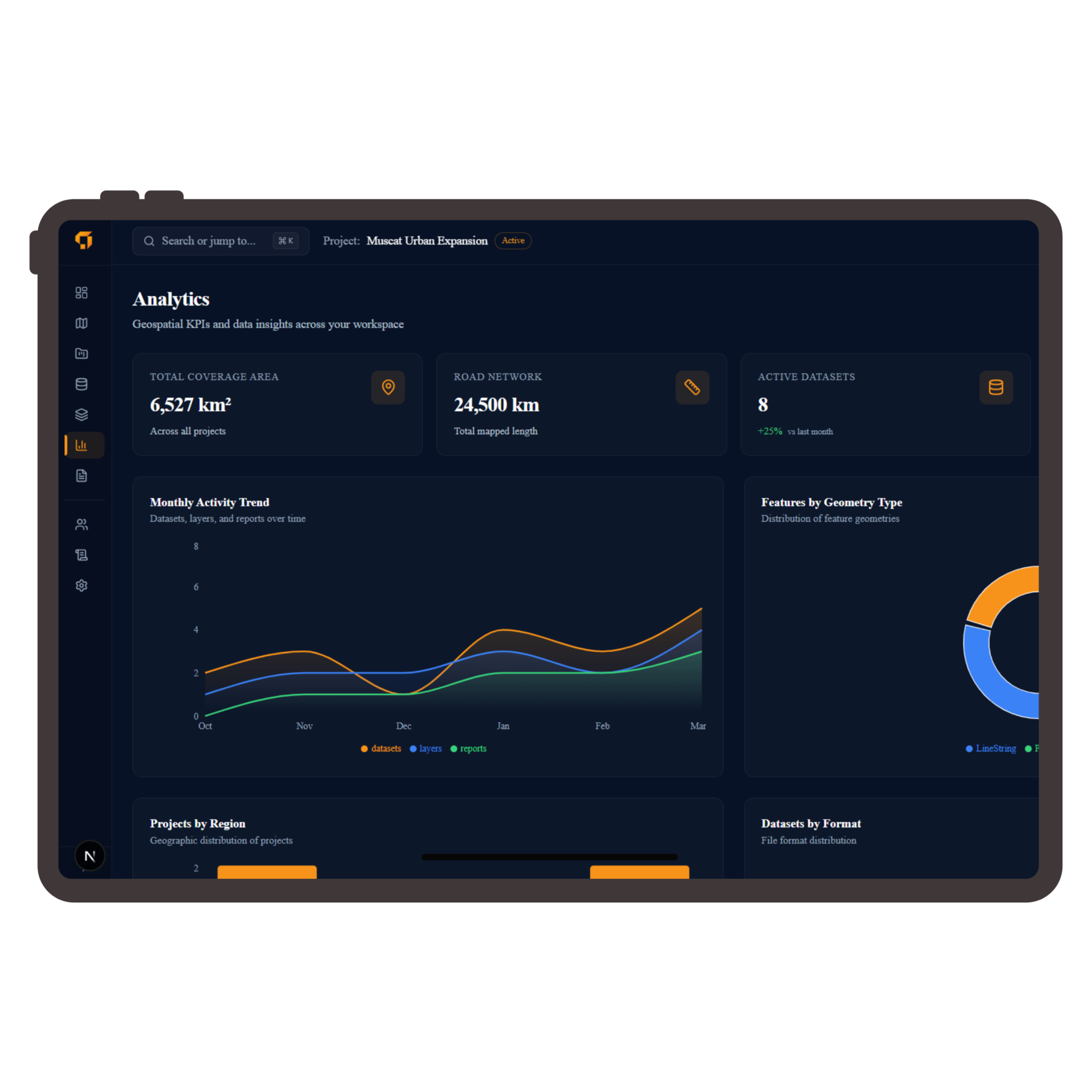
Data-Driven Decisions
Turn spatial complexity into actionable insights. Interactive dashboards provide the clarity needed for Oman's strategic planning.
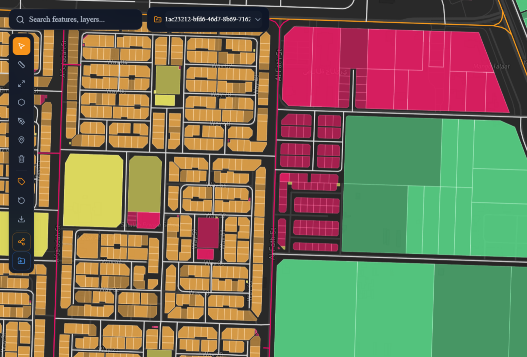
Precision Cartography
From LiDAR point clouds to multispectral satellite imagery, we provide the tools to visualize the unseen.
Regional Impact
Pioneering Oman's
Digital Frontier
Vision 2040 Alignment
Fueling the nation's technological ambitions through sovereign spatial data sovereignty and advanced analytics.
Infrastructure Backbone
Providing the geospatial foundation for sustainable urban growth and ecological preservation across the Sultanate.

Trusted By
Leading Organizations in Oman